Open Geospatial Consortium
Advertisement
PyOGCLib v.b.0.1.0
PyOGCLib is a package of classes that implement specifications of the Open GIS Consortium (OGC), allowing Python applications to spatially plug-and-play with other geoprocessing systems.
Advertisement
GvSIG desktop v.2.0.0.2023
gvSIG Desktop is a powerful geographic information system (GIS) designed to offer a free solution to all needs related to geographic information management.
Framework WMS.net v.2.0.1.20
A Web Map Service (WMS) is a standard protocol for serving georeferenced map images over the Internet that are generated by a map server using data from a GIS database.
Advanced Points Manager v.1.0
The Advanced points manager imports points to AutoCAD drawing from different data sources. OLE-DB database, SHP (ESRI shape file), GPX (GPS eXchange format), KML (Keyhole Markup Language), GML (Geography Markup Language), TXT, CSV.
TNTmap Widget v.2007:73
TNTmap.
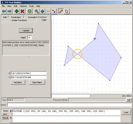
JTS Topology Suite v.1.12
The JTS Topology Suite is an API for modelling and manipulating 2-dimensional linear geometry.
KML To CSV Converter Software v.7.0
This software offers a solution to users who want to convert one or many KML files into CSVs. The user may choose to the delimiting character: comma, comma-space, semi-colon, tab or other.
MapGuide Open Source Release v.2.2.0.5703
MapGuide Open Source is a web-based platform that enables users to develop and deploy web mapping applications and geospatial web services.
ILWIS Open v.3.6.0.1
ILWIS Open integrates image, vector and thematic data in one unique and strong desktop package. It delivers a wide range of feautures including import/export, digitizing, editing, analysis and display of data,

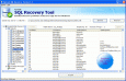
Open SQL Database v.4.10
SysTools SQL Recovery Tool to open SQL database, open MDF database, read SQL database and repair corrupt SQL database created using SQL Server 2000, SQL Server 2005 and SQL Server 2008 without any attempts.